


Mont Rosset

franquen
User
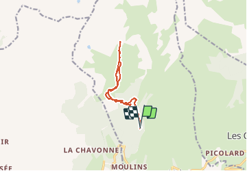

Length
12.4 km

Max alt
2430 m

Uphill gradient
1038 m
Km-Effort
26 km

Min alt
1411 m

Downhill gradient
1037 m
Boucle
Yes
Creation date :
2020-01-19 07:44:17.47
Updated on :
2020-01-19 16:23:25.902
5h27
Difficulty : Medium

FREE GPS app for hiking
 SityTrail
IGN / Geographical institutes
SityTrail Plus
The world is yours!
About
Trail Touring skiing of 12.4 km to be discovered at Auvergne-Rhône-Alpes, Savoy, La Plagne-Tarentaise. This trail is proposed by franquen.
Description
super conditions à la descente
Positioning
Country:
France
Region :
Auvergne-Rhône-Alpes
Department/Province :
Savoy
Municipality :
La Plagne-Tarentaise
Location:
La Côte-d'Aime
Start:(Dec)
Start:(UTM)
318335 ; 5051328 (32T) N.
Comments